
- Great Basin LCC CPA |
- Collaborating in the Conservation Planning Atlas
Collaborating in the Conservation Planning Atlas
Data Basin is a web-based GIS, meaning that it offers a variety of features common to desktop GISs within a cloud-based system. This allows users to perform several familiar functions of desktop GIS - including creating custom symbology, buffering, filtering, intersecting, and performing analysis - in an environment that allows collaboration. The Great Basin LCC offers technical and data support to regional organizations using the CPA for their activities. Let's explore some of these features in greater depth: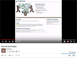
Groups are created by members to collaborate around specific topics or geographies, and control who is granted access to resources within the system. Group's members can share, analyze, and discuss public and private datasets, maps, and supporting documentation. This means that each member of the group accesses the same datasets and maps as every other user, enhancing quality assurance by reducing use of outdated data resources. Within each group an administrator has autonomy to structure data and resources however they like, and can send messages to communicate.
See a demonstration of Groups in this short video.
Collaborative Features
ScienceBase and DOI Credentials
Collaborative Features
Data Basin offers a variety of features that help teams to collaborate in geospatial planning - including sharing, commenting, and drawing. By sharing maps and other products with users or groups, teams can have discussions and arrive at shared decisions. Commenting and drawing within a geospatial interface allows teams to dynamically participate in group discussions.
Learn more about commenting features in this short video.
ScienceBase and DOI Credentials
Data Basin integrates with the USGS's cloud-based science database, ScienceBase. By connecting a Data Basin account with DOI credentials through ScienceBase, users can add additional protection to particularly sensitive datasets. Additionally, Data Basin's integration with ScienceBase extends to geospatial web services published through ScienceBase, ArcGIS Online and ArcGIS Rest Services.
Because Data Basin's membership it open, it can be used by users across agencies and organizations.
GBLCC Support
At the Great Basin LCC, one of our primary goals is to help "Great Basin communities to develop mutually agreed upon landscape-scale conservation strategies..." Toward that aim, we extend support to your data and technical needs in the Conservation Planning Atlas. We are available to provide presentations and webinars to help your team get up and running, and to identify and integrate the datasets your team needs into the Conservation Planning Atlas.
Contact GBLCC's Geospatial Data Specialist, Eric Jensen, for more information: ejensen@blm.gov